
Coffee Region
A UNESCO-listed coffee landscape, towns of painted balconies, wax palm forests and mountain hot springs, about an hour's flight from Bogotá.
- Where it is
- The Central Cordillera of the Andes, across Caldas, Quindío, Risaralda and northern Valle del Cauca.
- Getting there
- Direct flights from Bogotá take about an hour to Pereira (Matecaña) and Armenia (El Edén), with flights to Manizales (La Nubia) too. From Medellín, direct flights to Pereira and Armenia take under an hour.
- Weather
- Mild mountain climate: Pereira averages 21 °C (70 °F) and Salento about 17 °C (63 °F), while the páramo (high-altitude moorland) of Los Nevados gets bitterly cold. Two rainy seasons a year.
- Documents
- Colombian ID (cédula) or other valid ID for residents; passport for foreign visitors. For Los Nevados: a booking, accident insurance and an authorized guide.
- Money
- Colombian peso (COP). Cards work in cities and hotels; bring cash for rural areas, Willys jeeps and the access fees charged on private land in the Cocora Valley.
- Language
- Spanish.
- Time zone
- Same time as the rest of Colombia (UTC-5).
- Plugs
- Types A and B, 110 V, 60 Hz.
Coffee mountains, wax palms and mist
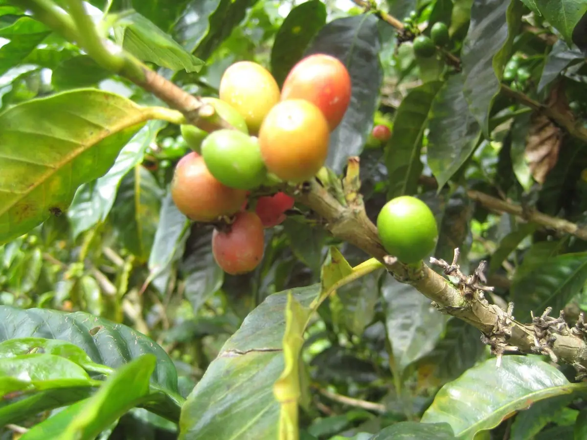
Colombia's Coffee Cultural Landscape has been a World Heritage Site since 2011. It takes in parts of 47 municipalities and 411 veredas (rural districts) across Caldas, Quindío, Risaralda and northern Valle del Cauca, where thousands of families grow coffee on steep hillsides. Here you measure the trip in cups: you walk a farm, watch the beans being picked, pulped, dried and roasted, then taste the result with someone whose family has done this for generations.
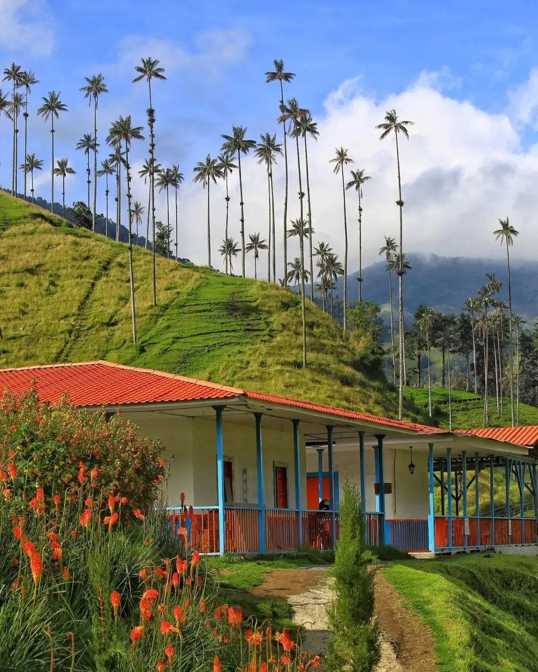
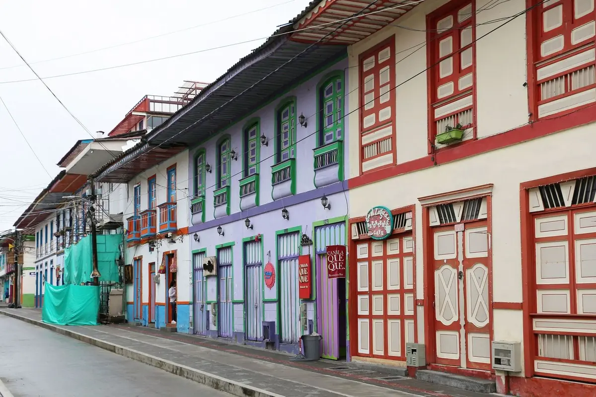
There's a lot more around the coffee. Salento is the gateway to the Cocora Valley, home of the wax palm, Colombia's national tree. Filandia keeps its bahareque (wattle-and-daub) streets and painted balconies. Santa Rosa de Cabal has hot springs tucked into the mountains, and from Manizales you can head up into Los Nevados National Natural Park, where the Nevado del Ruiz volcano is under constant monitoring. After the August 10, 2026 earthquake, the region is open to visitors and is asking travelers to support local tourism.
Don't miss
-
01
Cocora Valley
About 11 km (7 mi) from Salento, reached by Willys jeep from the main square. Choose a short one- to two-hour walk or a long five- to six-hour loop through wax palms, cloud forest and hanging bridges.
-
02
Salento and its lookout
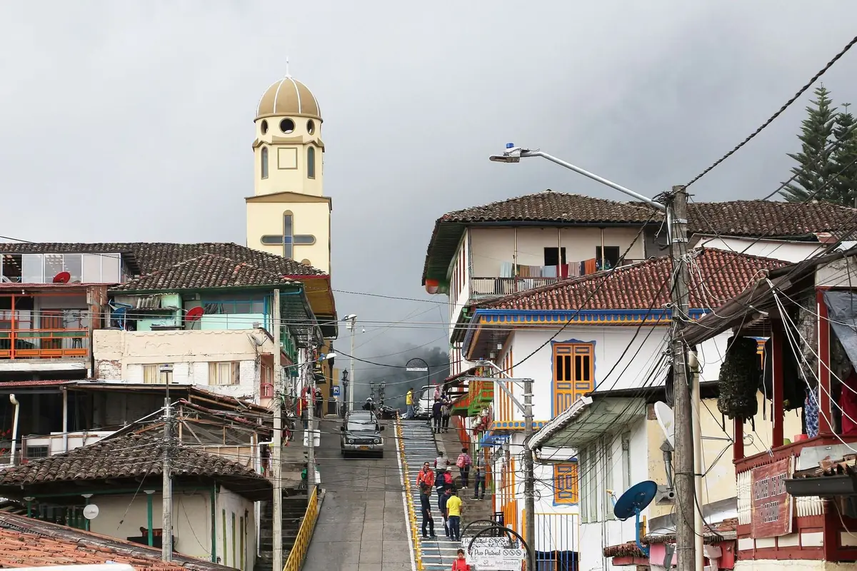
Quindío's oldest town sits at 1,895 meters (6,217 ft). Wander its streets of bahareque houses, then climb the 242 steps to the Alto de la Cruz lookout for a view over rooftops and mountains.
-
03
Inside a coffee farm
In rural districts like Boquía and Palestina, near Salento, farms walk you through the whole process: picking, processing, drying, roasting and a guided cupping of specialty coffees. It's the best way to understand the landscape UNESCO protects.
-
04
Filandia
Streets of painted balconies, classic coffee-country architecture and mountain views. The Colina Iluminada lookout was damaged in the August 2026 earthquake, and its future depends on a new technical study, so check whether it's open before you go.
-
05
Santa Rosa de Cabal hot springs
Hot spring pools set in the mountains, a few minutes from Pereira. After the earthquake, the local government reported the springs are operating normally. The right way to end a day of hiking.
-
06
Los Nevados from Manizales
The Brisas-Kumanday sector takes you by vehicle to the Valle de las Tumbas, a near-lunar superpáramo above 4,000 meters (13,100 ft). The Nevado del Ruiz volcano remains on yellow alert: visits are guided and depend on conditions.
When to go
December to February are the driest months and the best for hiking Cocora or heading up to Los Nevados under clear skies. June to August are good too, with less rain. April, May, October and November bring most of the rain: trails get slippery and fog hides the views. If Los Nevados is on your list, try to avoid the last week of September, the last week of November and Holy Week, when the park closes.
- Jan: Best. Dry; first weeks are very busy
- Feb: Best. Dry, with fewer visitors
- Mar: Good. Rains begin; Los Nevados closes Holy Week
- Apr: Rainy. First rainy season
- May: Rainy. Frequent rain, muddy trails
- Jun: Good. Less rain; midyear school holidays
- Jul: Good. Less rain; high holiday demand
- Aug: Good. Fairly stable weather
- Sep: Good. Rains return; Nevados closes fourth week
- Oct: Rainy. Second rainy season
- Nov: Rainy. Rainy; Nevados closes fourth week
- Dec: Best. Dry season returns; book ahead
-
Best
Dec – Feb
The best time to go.
-
Good
Mar · Jun – Sep
A good time, with a catch on weather or crowds.
-
Rainy
Apr – May · Oct – Nov
More rain: keep plans flexible.
What you need to travel
For Colombian travelers: all you need to travel the region is your ID. Los Nevados National Natural Park has its own rules: a mandatory guide, accident insurance, age limits and bookings, plus restrictions tied to activity at the Nevado del Ruiz volcano. Traveling on another passport? Requirements differ, so message us and we'll check yours.
Checked in September 2026 with National Natural Parks of Colombia: Los Nevados National Natural Park. Rules change, so we confirm what applies to you when you book.
- Colombian ID (cédula) or other valid ID for residents (tarjeta de identidad or birth certificate for minors); passport for foreign visitors.
- Los Nevados: you must be accompanied by an authorized guide or operator; in Brisas-Kumanday, the operator is Unión Temporal Operación Nevados.
- Los Nevados: accident insurance is mandatory; minimum age is 6 in Brisas-Kumanday, and maximum age is 69 throughout the park.
- Los Nevados: booking one day ahead is recommended for Brisas-Kumanday and required in other sectors (3 business days for El Cisne and Laguna del Otún, 5 for Quindío-Dulima).
- 2026 entry fee for Los Nevados: COP 24,500 for Colombians and residents over 25, COP 12,500 for under 25; insurance is extra.
- Environmental vehicle restriction (pico y placa) on the road to Brisas-Valle de las Tumbas on weekends and holiday weekends, 5 a.m. to 4 p.m. (Resolution 1815 of 2026, Tolima Transit Department).
- The park closes for five business days during Holy Week, the fourth week of September and the fourth week of November.
- The Nevado del Ruiz volcano is on yellow alert according to the Colombian Geological Service (bulletin of August 4, 2026); access from Brisas goes only as far as the Valle de las Tumbas.
Take the full guide with you
Entry requirements, best months, local tips and our favorite places to eat in the Coffee Region, in a PDF you can keep on your phone.
Bokana tips
What we've learned running trips, and what we'd tell a friend before they go.
-
Dress in layers
In a single day you go from 21 °C (70 °F) in Pereira to just a few degrees in the páramo. Pack a rain jacket, a warm coat for Los Nevados and shoes with real grip: the Cocora trails are always muddy.
-
Get to Cocora early
Catch one of the first Willys jeeps from Salento's main square. You'll walk in better weather with fewer people. Bring small bills: the private properties along the trail each charge their own access fee.
-
Check the volcano before you go up
The Colombian Geological Service publishes a weekly bulletin on Nevado del Ruiz. Read it before heading to Brisas, and always follow your guide and National Parks staff.
-
Take the altitude slowly
The Valle de las Tumbas sits above 4,000 meters (13,100 ft). Sleep well the night before, eat light, stay hydrated and tell your guide if you feel dizzy or get a headache. The park restricts entry for people with certain health conditions.
-
Pick the right airport
Armenia is closer to Salento and Filandia; Pereira is closer to Santa Rosa de Cabal. Since the earthquake, Matecaña has been operating from the terminal's ground floor. La Nubia, in Manizales, reports 91.6% operability in 2026.
-
Coming by road
Medellín to Pereira is about 220 km (137 mi), roughly five hours. From Bogotá, the La Línea route was reduced to a single lane with stop-and-go traffic after a landslide in July 2026; check with Invías, the national roads agency, before you set out.
-
Spend locally
Buy coffee straight from the farm or from producer shops, and hire local guides. Since the earthquake, businesses in towns like Salento and Filandia depend heavily on every visitor.
What to eat
Single-origin coffee
Try it at the farm, freshly roasted and brewed by pour-over methods that bring out each lot's acidity and sweetness.
Trout
A staple at restaurants in Salento and Cocora, cooked al ajillo (in garlic) or on the griddle, almost always with patacón (fried green plantain).
Bandeja paisa and beans
A legacy of the settlers from Antioquia: beans, rice, meat, chicharrón (crispy pork belly), egg, plantain and arepa. A plate for after the hike.
Corn arepa
It comes with almost everything. At a farm breakfast it usually arrives with fresh cheese and a hot chocolate or tinto (black coffee).
Group trips to the Coffee Region
Book your own spot, travel with a group, and have someone from Bokana with you the whole way.
Picture yourself in the Coffee Region?
Let's plan it together.
Join one of our groups or bring your own people on a private trip.
More destinations in Colombia
Sources and photo credits
- Parques Nacionales Naturales: PNN Los Nevados (tarifas 2026, sectores, reglas, pico y placa)
- Servicio Geológico Colombiano: boletín semanal del volcán Nevado del Ruiz, 28 de julio al 3 de agosto de 2026
- Ley 61 de 1985, palma de cera como árbol nacional (Función Pública)
- Ministerio de Cultura: el Paisaje Cultural Cafetero celebra 14 años como Patrimonio Mundial
- Wikipedia: Paisaje Cultural Cafetero (municipios, veredas, fecha de inscripción)
- Alcaldía de Pereira: geografía (altitud y temperatura)
- Wikipedia: Salento (Quindío) (altitud y temperatura)
- Eje21: régimen de lluvias en la región Andina, citando al IDEAM
- El Tiempo: IDEAM, noviembre en la segunda temporada de lluvias en la región Andina
- La Patria: Salento, café, palmas de cera y naturaleza
- Crónica del Quindío: Salento busca reactivar el turismo tras el terremoto (18 de agosto de 2026)
- El Espectador: a un mes del terremoto, destinos turísticos insisten en no cancelar viajes (10 de septiembre de 2026)
- La Cuyabra Radio: nuevo concepto técnico sobre el Mirador de Filandia (28 de septiembre de 2026)
- La Cuyabra Radio: Parque del Café reabre el 19 de agosto de 2026
- Crónica del Quindío: Panaca reabre el 15 de agosto de 2026
- Ciudad Región: operación del Aeropuerto Matecaña tras el sismo
- La Patria: obras en fachadas del Aeropuerto Matecaña hasta diciembre
- Aeronáutica Civil: reapertura gradual de aeropuertos tras el sismo
- Eje21: La Nubia suma una nueva conexión aérea con Medellín (17 de septiembre de 2026)
- KAYAK: ruta Bogotá-Armenia (duración de vuelo directo)
- KAYAK: ruta Bogotá-Pereira
- Skyscanner: ruta Medellín-Pereira
- Semana: vía La Línea con paso controlado (5 de agosto de 2026)
- Rome2rio: Medellín a Pereira por carretera
- La Patria: Santa Rosa de Cabal comienza a levantarse tras el terremoto
- Triviantes: tour al Valle del Cocora desde Salento (distancia, Willys, duración de rutas)
- El Quindiano: uso de palma de cera en Domingo de Ramos y control de la CRQ
- World Standards: enchufes y voltaje por país
- Google Maps (fichas consultadas el 1-oct-2026)
- Festival de la Trucha Salento 2026, restaurantes participantes
- Semana: Salento busca recuperar visitantes tras el terremoto (24-ago-2026)
- Semana: Festival de la Trucha con más de 40 restaurantes (15-sep-2026)
- El Tiempo: descenso del turismo en el Quindío tras el terremoto (11-sep-2026)
- Alerta: 46 % de los gastrobares de Pereira sigue cerrado
- La Patria: pódcast sobre restaurantes de Manizales afectados por el sismo (23-sep-2026)
- Eje21: Manizales entra en una nueva fase tras el terremoto
- El Tiempo: Helena Adentro, mejor restaurante del Eje Cafetero (premios La Barra)
- Restaurant Guru: Helena Adentro (calificaciones agregadas, act. 28-sep-2026)
- Wikipedia: Terremoto de Colombia de 2026
Photos: Bernard Gagnon (CC BY-SA 4.0), Wikimedia Commons · U. S. Fish and Wildlife Service - Northeast Region (Public domain), Wikimedia Commons · Bernard Gagnon (CC BY-SA 4.0), Wikimedia Commons.