
Guatapé
Less than two hours from Medellín, you climb a 220-meter (722 ft) rock, cruise a reservoir of green islands and walk a town that tells its story on its walls.
- Where it is
- Eastern Antioquia, about 75 to 81 km (47 to 50 mi) from Medellín via the Medellín-Bogotá highway and the Marinilla-El Peñol-Guatapé road.
- Getting there
- No airport. Fly into Medellín (José María Córdova, in Rionegro), about 64 minutes direct from Bogotá, then continue by road into eastern Antioquia.
- Weather
- Mild: Guatapé averages about 20 °C (68 °F), ranging from 13 to 22 °C (55 to 72 °F). Strong sun at midday, and two rainy seasons a year.
- Documents
- Colombian ID (cédula) or other valid ID for residents; passport for foreign visitors. No tourist card or entry fee for the town.
- Money
- Colombian peso (COP). Many hotels and restaurants take cards; bring cash for boats, small shops and ticket booths.
- Language
- Spanish.
- Time zone
- Same time as the rest of Colombia (UTC-5).
- Plugs
- Types A and B, 110 V, 60 Hz.
The rock, the reservoir and the zócalos
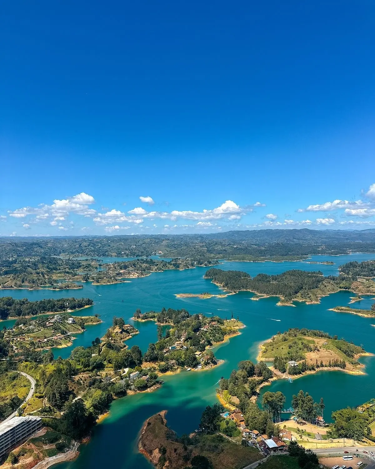
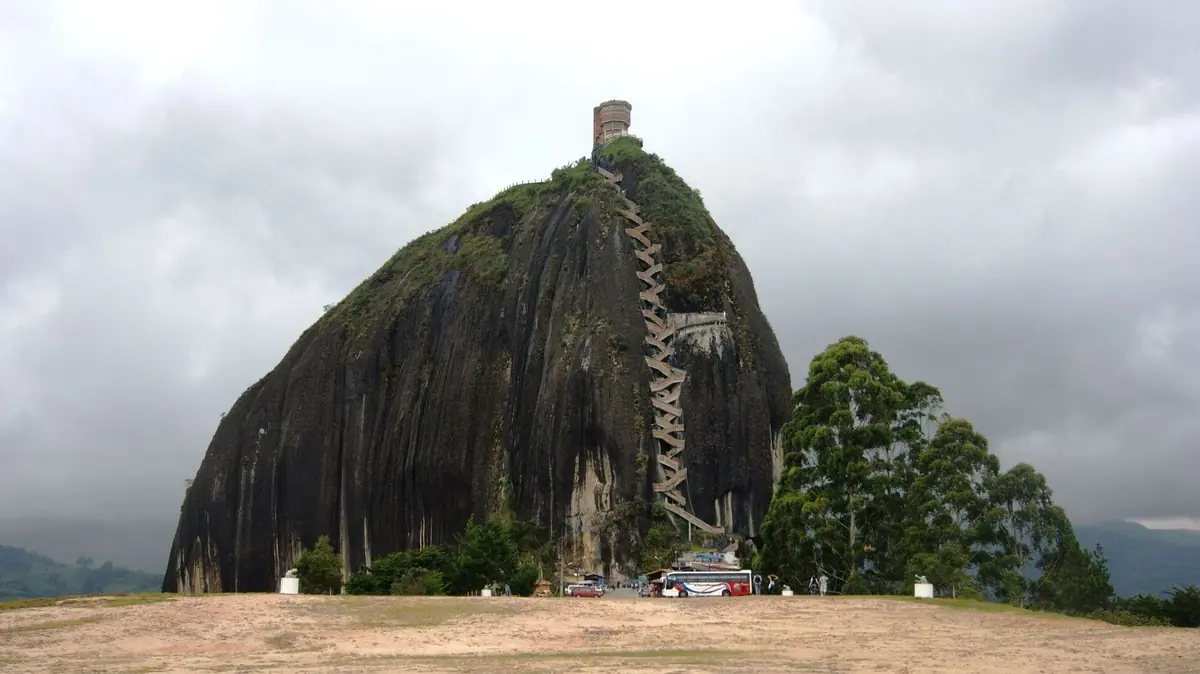
Guatapé and El Peñol share one of Antioquia's most recognizable landscapes. The Piedra del Peñol, a granite monolith 220 meters (722 ft) tall, rises over the Peñol-Guatapé reservoir, more than 6,300 hectares (15,500 acres) of water full of inlets and islands. From the top, reached by a staircase built into a crack in the rock, you see why this corner of eastern Antioquia draws visitors all year.
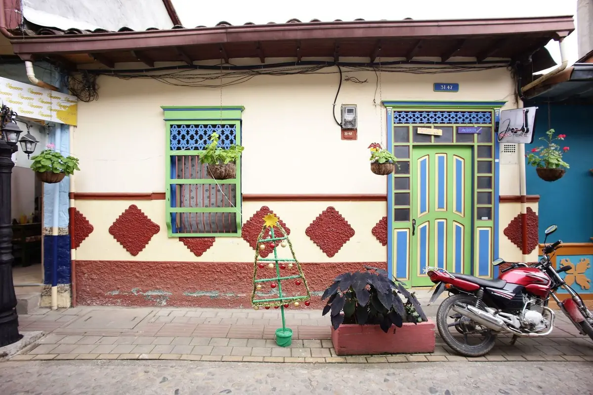
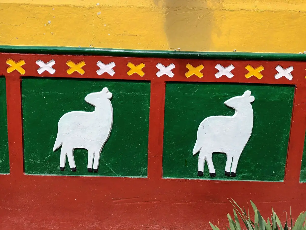
Down below, Guatapé is known as the town of zócalos: colorful relief panels along the base of the houses that show trades, families and scenes of local life, a tradition that began around 1919. Nearby, El Peñol keeps the memory of its old town center, flooded in the 1970s to create the reservoir, in a replica that rebuilds the plaza, the church and the town hall. It's an easy day trip from Medellín, though it's worth staying the night.
Don't miss
-
01
Climb the Piedra del Peñol
More than 650 steps zigzag up a crack in the monolith, open daily 8 a.m. to 5 p.m. Look for the letters painted on the rock: they're the mark of an old rivalry between Guatapé and El Peñol.
-
02
The view from the top
Up top, the Peñol-Guatapé reservoir spreads out in almost every direction: more than 6,300 hectares (15,500 acres) of water, peninsulas and green islands. Morning light is best for photos.
-
03
Guatapé's zócalos
Walk the Plazoleta de los Zócalos and the streets of the town center. Each relief panel tells a story: a trade, a family, a belief. Neighbors paint and restore them together in community work days, and the town protects them as heritage.
-
04
Boat ride on the reservoir
Boats leave the Guatapé waterfront all day. A basic ride takes about 45 minutes and passes islands and country estates; longer trips with stops are also available.
-
05
Replica of Old El Peñol
The original town of El Peñol went underwater in the 1970s. The replica rebuilds its plaza, church and town hall. Out on the reservoir, the Cross of Old El Peñol marks where the church once stood.
-
06
Waterfront and water sports
Guatapé's malecón runs about 900 meters (2,950 ft) along the water. This is where you book kayaks, boats and other activities. At sunset it's a good place for an unhurried walk.
When to go
Guatapé works all year. December to February and June to August tend to be drier, with better views from the rock. April, May, October and November bring more rain, usually in the afternoon. Crowds matter more than weather: weekends, holiday weekends, Holy Week and the year-end holidays pack the town and the staircase. If you can, go on a weekday and arrive early.
- Jan: Best. Dry; first weeks are very busy
- Feb: Best. Dry, with fewer crowds
- Mar: Good. Rains begin; Holy Week gets packed
- Apr: Rainy. First rainy season
- May: Rainy. Afternoon downpours
- Jun: Good. Less rain; several holiday weekends
- Jul: Good. Less rain; school holidays
- Aug: Good. Stable weather; busy holidays
- Sep: Good. Rains gradually return
- Oct: Rainy. Second rainy season
- Nov: Rainy. Rainy; climb the rock early
- Dec: Best. Dry season returns; peak season
-
Best
Dec – Feb
The best time to go.
-
Good
Mar · Jun – Sep
A good time, with a catch on weather or crowds.
-
Rainy
Apr – May · Oct – Nov
More rain: keep plans flexible.
What you need to travel
For Colombian travelers: there are no special entry requirements, just your ID. The climb up the Piedra del Peñol is paid at the ticket booth on site, which is privately owned. Traveling on another passport? Requirements differ, so message us and we'll check yours.
Checked in September 2026 with El Peñol Municipal Government: Places of Interest. Rules change, so we confirm what applies to you when you book.
- Colombian ID (cédula) or other valid ID for residents (tarjeta de identidad or birth certificate for minors); passport for foreign visitors.
- Piedra del Peñol climb: COP 35,000 per person in 2026, a single year-round rate announced by the site's management on January 1, 2026.
- Rock hours: daily, 8 a.m. to 5 p.m.
- No booking needed to climb the rock, and no entry fee for the town.
Take the full guide with you
Entry requirements, best months, local tips and our favorite places to eat in Guatapé, in a PDF you can keep on your phone.
Bokana tips
What we've learned running trips, and what we'd tell a friend before they go.
-
Climb first thing
The rock opens at 8 a.m. Get there before 9: you skip the lines, the sun isn't scorching yet and the light is at its best. Tour groups from Medellín usually arrive around midday.
-
Skip weekends and holidays
On weekdays you can climb the stairs at your own pace. Weekends, holiday weekends and school vacations bring long lines and a packed town. If a weekend is your only option, stay overnight.
-
Getting there by bus
Direct buses to Guatapé and El Peñol leave Medellín's Terminal del Norte all day, starting at 6 a.m. The ride takes about two hours and passes the rock before reaching town.
-
Get ready for the stairs
There are more than 650 steps. Bring water, a hat, sunscreen and comfortable shoes, and take all the breaks you need at the landings. There's no rush.
-
Life jacket on, always
On a boat or kayak, wear a life jacket the whole time and choose licensed operators on the waterfront. If you see an afternoon storm coming, save the ride for the next morning.
-
Keep cash handy
Many small businesses and boat operators prefer cash. Carry small bills, since change isn't always available.
-
One night changes everything
A day trip leaves little time. Stay over in Guatapé and you see the town at night without the crowds, climb the rock as soon as it opens and take the boat ride without hurrying.
What to eat
Bandeja paisa
Antioquia's signature platter: beans, rice, ground beef, chicharrón (crispy pork belly), egg, ripe plantain, avocado and arepa. Save it for after the climb down.
Trout
On almost every menu in town and along the waterfront, fried or al ajillo (in garlic), with patacón (fried green plantain) and salad.
Arepa with quesito
Every Antioquia morning starts with one, topped with fresh cheese and served with hot chocolate or a tinto (black coffee) before you head to the rock.
Group trips to Guatapé
Book your own spot, travel with a group, and have someone from Bokana with you the whole way.
Picture yourself in Guatapé?
Let's plan it together.
Join one of our groups or bring your own people on a private trip.
More destinations in Colombia
Sources and photo credits
- Alcaldía de El Peñol: sitios de interés (piedra, réplica del Viejo Peñol, embalse)
- Alcaldía de Guatapé: geografía (altitud, temperatura, distancia a Medellín)
- Medellín Travel (Bureau de Medellín): Guatapé
- Infobae: en 2026 será más caro subir a la Piedra del Peñol (7 de enero de 2026)
- La FM: nuevos precios para subir a la Piedra del Peñol en 2026
- Semana: horarios y precio de la Piedra del Peñol (2025)
- El Colombiano: hace 70 años se escaló El Peñol
- Wikipedia: El Peñón de Guatapé
- DiariOriente: zócalos de Guatapé
- Ecoturismo Colombia: guía de Guatapé 2026 (bus, horarios, lanchas)
- Rome2rio: Terminal del Norte a Guatapé
- KAYAK: ruta Bogotá-Medellín (duración de vuelo directo)
- Eje21: régimen de lluvias en la región Andina, citando al IDEAM
- World Standards: enchufes y voltaje por país
- Google Maps (fichas consultadas el 1-oct-2026)
Photos: Dtarazona (CC BY-SA 3.0), Wikimedia Commons · Javier Perez Montes (CC BY-SA 4.0), Wikimedia Commons · Alejandro Rojas (SajoR) (CC BY-SA 4.0), Wikimedia Commons.