
San Andrés
Reefs, cays fifteen minutes away by boat and a Raizal culture with its own language: San Andrés is Colombia's most remote and most distinctive slice of the Caribbean.
- Where it is
- Archipelago of San Andrés, Providencia and Santa Catalina, in the western Caribbean Sea, off the coast of Nicaragua.
- Getting there
- Direct from Bogotá: 2 hr to 2 hr 15 min. From Medellín: about 1 hr 50 min. There's also a direct route from Cali.
- Weather
- Warm year-round, averaging 27 to 28 °C (81 to 82 °F), with the sea at 26 to 27 °C (79 to 81 °F). Dry season from mid-January to April; rains from May to mid-January, with October the wettest month.
- Documents
- Colombian ID (cédula) for residents (or a minor's ID); passport for foreign visitors. Plus the tourist card, COP 153,000 in 2026, paid before you board.
- Money
- Colombian peso (COP). Hotels and larger shops take cards; bring cash for boats, taxis, attraction fees and small businesses.
- Language
- Spanish, English and San Andrés Creole, the native language of the Raizal people.
- Time zone
- Colombia time (UTC-5), no difference.
- Plugs
- Types A and B, 110 V, 60 Hz, same as the rest of Colombia.
The sea of seven colors, Raizal style
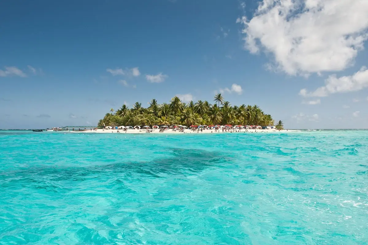
San Andrés is an island of about 27 km² (10 sq mi) in the middle of the Caribbean, off the coast of Nicaragua and far from mainland Colombia. A ring road of roughly 30 km (19 mi) loops all the way around, so in a single day you can take in natural pools, caves and lookouts. The water shifts from turquoise to deep blue depending on the seabed and the depth, which is why it's called the sea of seven colors. Boats leave from the pier for Johnny Cay, El Acuario and Haynes Cay.
The island is home to the Raizal people, descendants of Africans and British settlers, who speak Creole, a native language recognized in Colombia that lives alongside English and Spanish. The whole archipelago is part of the Seaflower Biosphere Reserve, declared by UNESCO in 2000, which holds more than three-quarters of the country's coral reefs. If you have more days, Providencia is a short flight away and runs at a slower pace.
Don't miss
-
01
Johnny Cay
A regional natural park 1.5 km (1 mi) off the island, about 15 minutes by boat. Open 9 a.m. to 4 p.m., weather permitting. Outside food and drinks aren't allowed, and there's an entrance fee paid to CORALINA, the islands' environmental authority.
-
02
El Acuario and Haynes Cay
Two cays almost joined by a sandbar where the water comes up to your waist. It's the classic outing for snorkeling among colorful fish and grabbing a bite at the Haynes Cay kiosks.
-
03
West View and La Piscinita
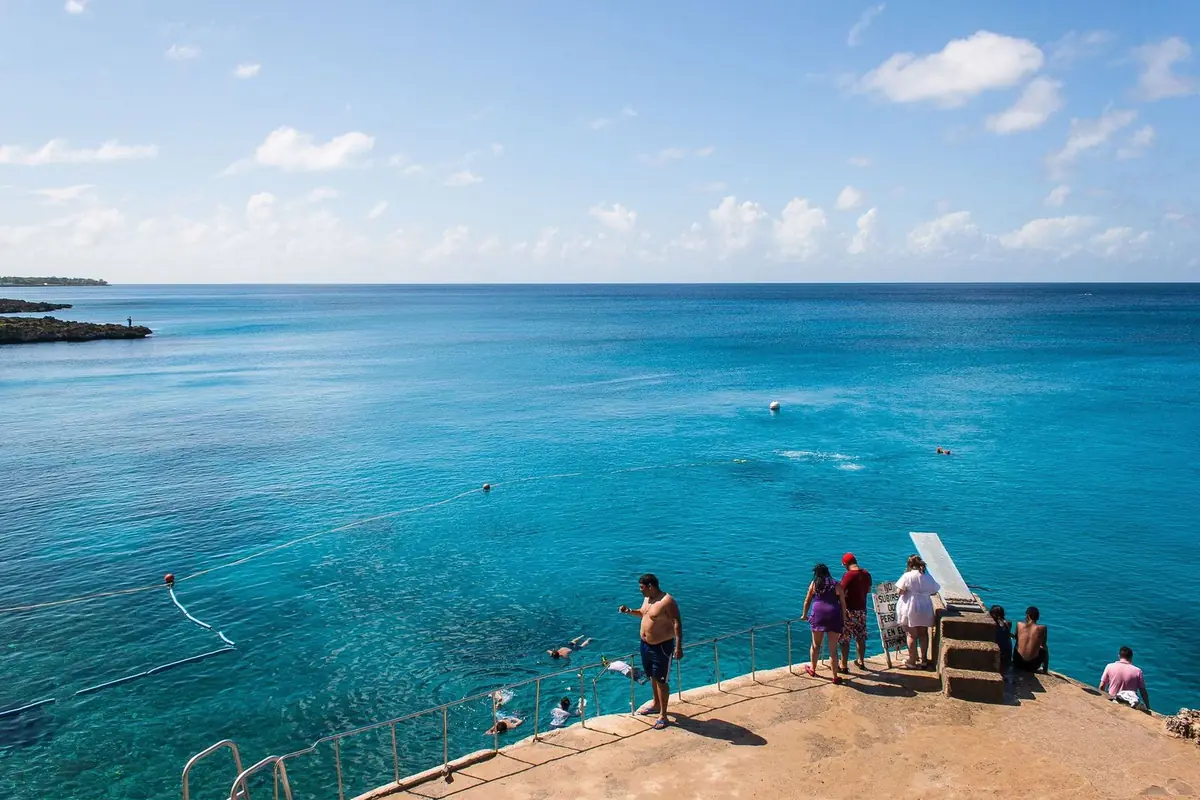
Natural pools along the rocky west coast of the island. At West View you get into the water by slide or diving board and see fish and coral just a few yards from shore.
-
04
Around the island
About 30 km (19 mi) of ring road you can cover by golf cart, scooter or bus. Stop at the Hoyo Soplador blowhole, where the sea shoots up through tunnels in the coral rock, at La Piscinita and at Morgan's Cave.
-
05
Raizal culture
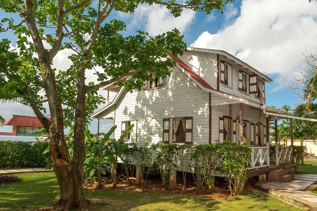
Wooden houses in island architecture, music, the Creole language and coconut-based cooking. Visiting the Casa Museo Isleña or eating rondón, a coconut-milk seafood stew, cooked by a Raizal family is the best way to understand the island.
-
06
Add on Providencia
A mountainous, quieter island in the same archipelago, rebuilt after Hurricane Iota in November 2020. Get there on a Satena flight from San Andrés or by catamaran, about three hours, which only runs on some days.
When to go
The best time is mid-January to April: it's the dry season, and March is the driest month. December, Holy Week and midyear are high season, with bigger crowds and high prices. Atlantic hurricane season runs June 1 – November 30, peaking from mid-August to mid-October; October is also the wettest month. If you travel then, get insurance.
- Jan: Good. Rains wind down; strong breeze
- Feb: Best. Dry season, clear water
- Mar: Best. The driest month of the year
- Apr: Best. Dry; Holy Week gets very busy
- May: Good. Rains begin, fewer visitors
- Jun: Rainy. Hurricane season starts; humid heat
- Jul: Rainy. School holidays, rain and humid heat
- Aug: Rainy. Higher risk of tropical storms
- Sep: Avoid. Peak of hurricane season
- Oct: Avoid. Rainiest month; hurricane risk
- Nov: Rainy. Rainy; hurricane season ends on the 30th
- Dec: Good. High season; rains easing off
-
Best
Feb – Apr
The best time to go.
-
Good
May · Dec – Jan
A good time, with a catch on weather or crowds.
-
Rainy
Jun – Aug · Nov
More rain: keep plans flexible.
-
Avoid
Sep – Oct
Peak of hurricane season.
What you need to travel
For Colombian travelers: you don't need a passport to visit, but every nonresident visitor must pay the archipelago's tourist card before boarding. Keep the receipt for your entire stay. Traveling on another passport? Requirements differ, so message us and we'll check yours.
Checked in September 2026 with Government of the Archipelago of San Andrés, Providencia and Santa Catalina: Tourism Office. Rules change, so we confirm what applies to you when you book.
- ID: Colombian ID (cédula) for adult residents, tarjeta de identidad or registro civil (birth certificate) for minors; passport for foreign visitors.
- 2026 tourist card: COP 153,000 per person (Decree 0010 of January 8, 2026, from the Archipelago Government), made up of COP 116,000 for the entry fee and COP 37,000 toward tourism infrastructure.
- Buy it before boarding, at the airline counter at your departure airport. JetSMART also sells it on its website when you buy your ticket.
- Exempt: children under 7, people born in the archipelago and residents with a valid OCCRE card.
- The same card covers San Andrés, Providencia and Santa Catalina; travelers arriving by sea pay it too.
- When you buy it, you'll be asked for arrival and departure dates, personal details, flight, booking code and your accommodation's address, so have them handy.
- Entry to Johnny Cay and other regional parks: paid separately to CORALINA; children under 5 and Raizal residents don't pay.
Take the full guide with you
Entry requirements, best months, local tips and our favorite places to eat in San Andrés, in a PDF you can keep on your phone.
Bokana tips
What we've learned running trips, and what we'd tell a friend before they go.
-
Allow time for the tourist card
Get to the airport with extra time: the tourist card is paid at the counter before check-in. Flying JetSMART? You can add it when you buy your ticket.
-
Take the early boat
Head to Johnny Cay and El Acuario on the first boat of the morning. The sea is usually calmer and the cays are less crowded. Johnny Cay closes at 4 p.m.
-
Bring your own mask
Pack a snorkel mask and water shoes. You can rent gear at El Acuario and West View, but your own saves money and is more hygienic. Water shoes protect you from sea urchins and coral rock.
-
Take the golf cart slowly
For the island loop, rent a golf cart or scooter from a licensed operator, check the brakes and fuel, and follow traffic rules. The ring road has narrow stretches and buses.
-
Learn a Creole greeting
Many Raizal people appreciate a greeting in their language or in English. Ask before photographing people or homes, and look for restaurants and guesthouses owned by islanders.
-
Insurance and alerts in hurricane season
If you travel between June and November, buy insurance that covers weather cancellations and follow alerts from Colombia's National Disaster Risk Management Unit and the National Hurricane Center.
-
Water and sun
The sun is strong even when it's cloudy. Wear a rash guard for snorkeling, a cap and sunscreen free of oxybenzone and octinoxate, which are less harmful to coral.
What to eat
Rondón
The signature Raizal dish: a slow-cooked coconut-milk stew with fish or conch, cassava, yam, plantain, breadfruit and dumplings.
Crab back
Crab meat stewed with onion, garlic and bell pepper, served back in its shell.
Johnny cake
Fried bread with British roots that comes alongside fish and seafood at island tables.
Sopa de caracol
Conch soup with coconut milk, made with queen conch and typical of the archipelago. Ask whether conch is in its legal season.
Group trips to San Andrés
Book your own spot, travel with a group, and have someone from Bokana with you the whole way.
Picture yourself in San Andrés?
Let's plan it together.
Join one of our groups or bring your own people on a private trip.
More destinations in Colombia
Sources and photo credits
- Infobae: Gobernación de San Andrés adopta Decreto 0010 de 2026 sobre la tarjeta de turismo (5 feb 2026)
- El Espectador: nuevo precio de la tarjeta de entrada a San Andrés en 2026 y cómo comprarla
- Portafolio: tarjeta de turismo San Andrés 2026
- El Tiempo: cómo comprar la tarjeta de turismo por internet con JetSMART (2 jul 2026)
- Gobernación del Archipiélago: Secretaría de Turismo
- CORALINA: Johnny Cay Regional Park
- El Extra: tarifa de Johnny Cay y Old Point (ene 2022)
- UNESCO: Seaflower Biosphere Reserve
- NOAA: Tropical Cyclone Climatology
- El Universo: Iota devastó el 98 % de Providencia (16 nov 2020)
- Instituto Caro y Cuervo: criollo sanandresano
- Artesanías de Colombia: Creole, orgullosa lengua raizal
- Climas y Viajes: clima en San Andrés
- Trip.com: duración del vuelo Bogotá a San Andrés
- Satena: cómo llegar a Providencia
- El País Cali: cómo llegar a Providencia desde San Andrés
- El Tiempo: la ruta gastronómica raizal de San Andrés
- Wikipedia: Ruta Nacional 1 (circunvalar de San Andrés)
- Power Plugs & Sockets: Colombia
- Google Maps (fichas consultadas el 1 oct 2026)
- Tripadvisor: La Regatta
- Tripadvisor: Donde Francesca
- Tripadvisor: Aqua Beach Club
- Tripadvisor: Restaurante Lydia
- Wanderlog: La Regatta
- Wanderlog: Dónde comer en San Andrés
Photos: Mario Carvajal (CC BY 3.0), Wikimedia Commons (main photo) · Mario Carvajal (CC BY 3.0), Wikimedia Commons · Joao Carlos Medau (CC BY 2.0), Wikimedia Commons · Joao Carlos Medau (CC BY 2.0), Wikimedia Commons.